Staying Prepared: What to Know About New Orleans Weather This Week
New Orleans is no stranger to rapidly changing weather. This week highlights how critical staying updated on New Orleans weather can be, especially when heavy rain and flood warnings are in effect. Here’s what you should know about the current conditions and ways to protect yourself and your property.
Current Weather Outlook
As of early May 2025, severe rainfall has led to localized flooding across several parts of the city. The National Weather Service has placed the area under a Flash Flood Warning. Rain totals are expected to range from three to six inches, with some areas seeing even higher amounts. Storms are likely to persist through Thursday, and residents should anticipate water accumulating quickly on streets and low-lying areas.
Flooded Streets and Closures
Many New Orleans streets are already impacted by flooding. According to WDSU’s flood report, locations such as Canal Underpass, St. Claude & Gordon, and Frenchmen St at Chartres St are among those with standing water. Authorities strongly urge residents not to drive through flooded roads to avoid becoming stranded or damaging their vehicles.
For a complete and updated list of closures and affected streets, check the latest reports from local agencies. Visibility may be low in certain neighborhoods as water levels rise.
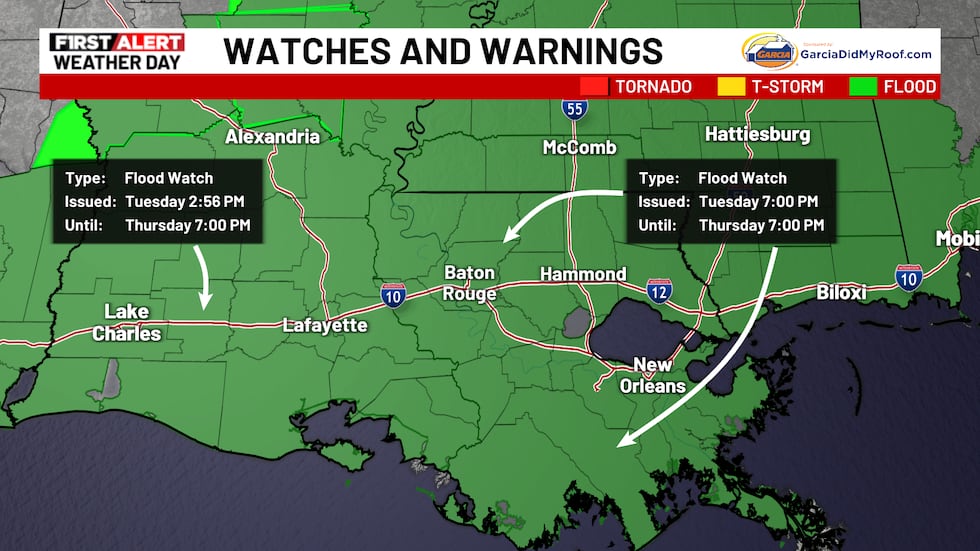
Severe Weather Precautions
The WAFB First Alert Weather Team has declared May 7 a First Alert Weather Day. Flood watches remain active for all of southeast Louisiana and southwest Mississippi. Residents should:
- Monitor local news and official weather sources.
- Keep portable devices charged for emergency alerts.
- Avoid unnecessary travel, particularly in known flood-prone zones.
- Prepare emergency kits with essential items in case of power outages or evacuation.
These steps help ensure you’re ready for sudden changes in New Orleans weather.
Keeping Up with Forecasts
Stay informed through multiple channels. Local news websites regularly post updates on radar images, flood threats, and school or business closure notices. It’s also helpful to learn about rain totals and historical flooding patterns in southeast Louisiana.
Summary: Stay Safe and Stay Tuned
New Orleans weather can change rapidly, especially in the spring. Flash floods pose significant risks, but you can lessen their impact by staying aware and prepared. Check reliable updates, heed official warnings, and always prioritize safety during severe weather events.